2024 Annual Report

Photo: Kurt Forman

The past year has been an exciting one as we have hired a new communications coordinator and added new faces to our Management Board. We have increased our efforts to define who we are and where we are headed as a JV coalition. I say coalition intentionally as we believe we can strengthen our collective efforts, i.e., JV staff and Management Board organizations, with clear purpose and renewed collaboration. We remain committed and optimistic about the future of the Prairie Pothole Region.

This past year, two long-standing JV Management Board members, Tom Watson from Montana Natural Resources Conservation Service (NRCS) and Rick Northrup from Montana Fish, Wildlife and Parks (FWP), retired from the JV Board and their agencies. We thank them for their unwavering commitment to the Prairie Pothole Region.

We also welcome six new JV Board members. Mike Borgreen from Bureau of Land Management (BLM) and Rachel Bush from The Nature Conservancy (TNC) filled vacant seats for their organizations, while four new organizations joined the Board. Representing these are Charlene Miller (Sisseton Wahpeton Oyate Tribe, South Dakota), Ryan Lankford (Assiniboine Gros Ventre Tribe and Montana agricultural producer), Julie Sibbing (National Wildlife Federation), and Carey Farmer (ConocoPhillips). These additions have already brought fresh perspectives on JV purpose and our approach to conservation.

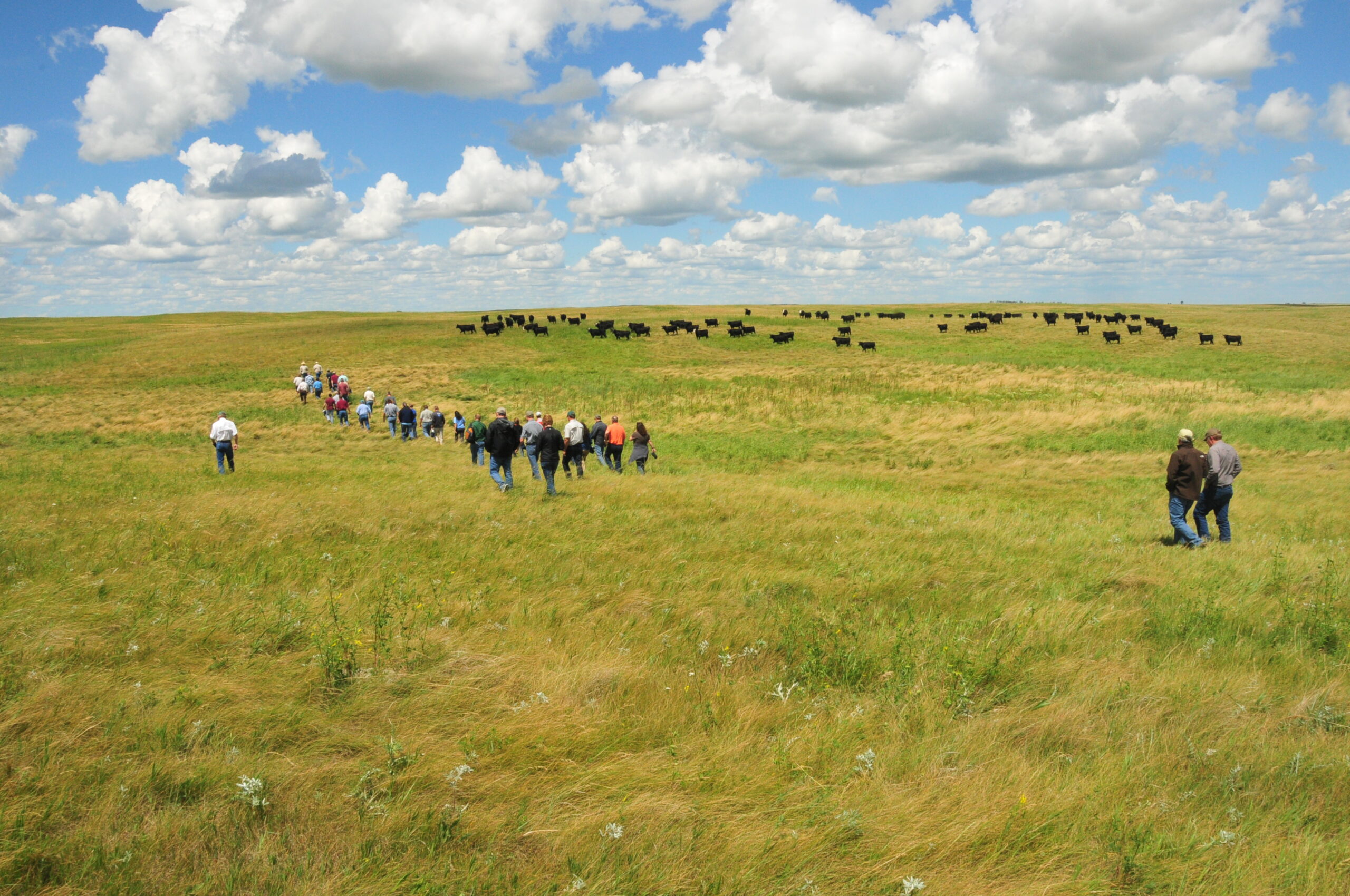
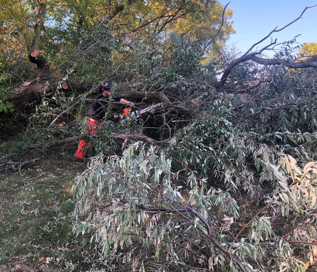
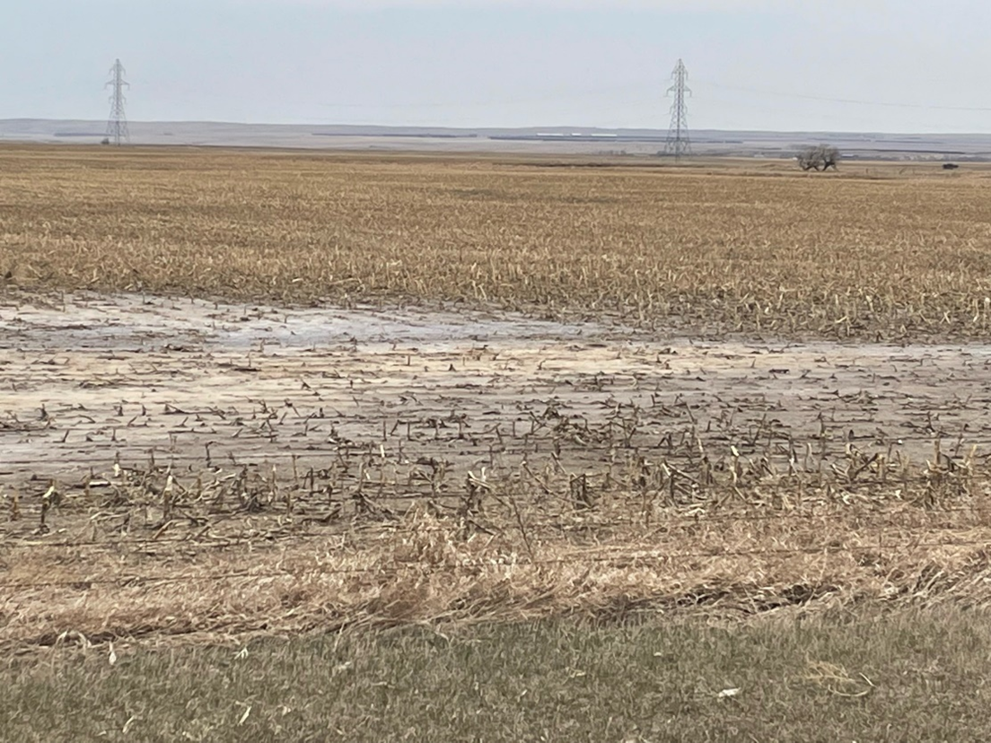
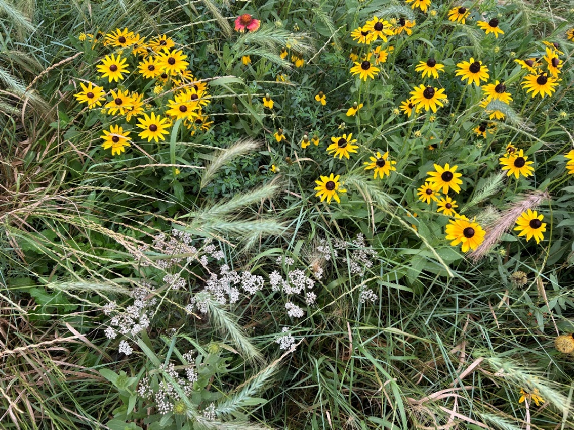
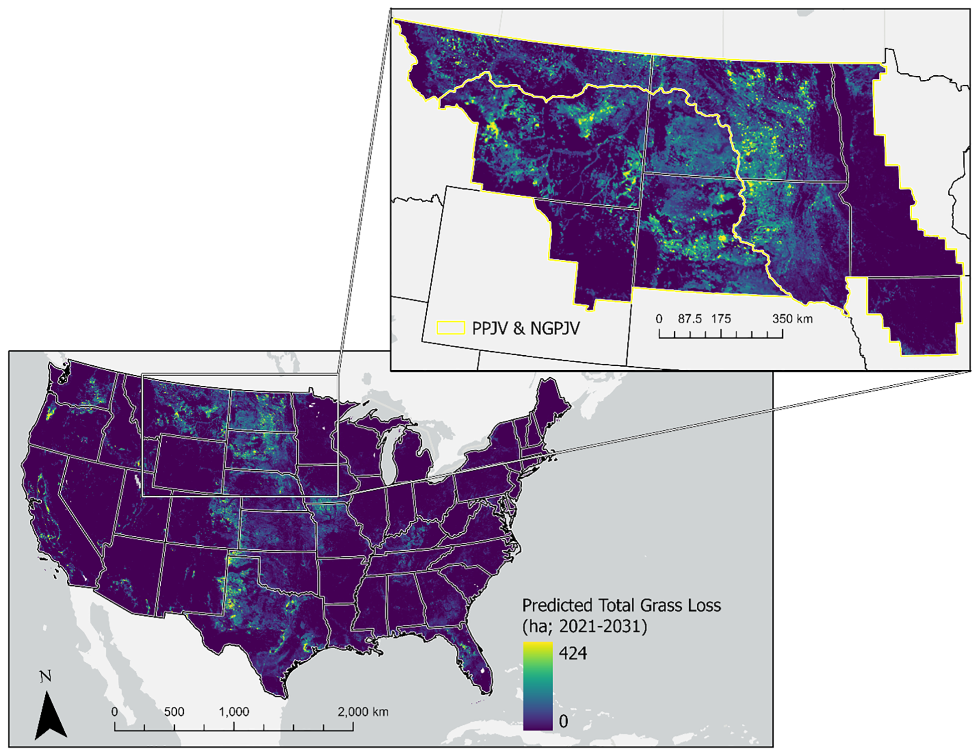
For this year’s annual report we are highlighting the efforts of our federal partners who continue to be a bedrock for conservation in the PPR. We would not be informing conservation actions without the strong science collaborations of the U.S. Fish and Wildlife Service (USFWS) Habitat and Population Evaluation Team (HAPET) and U.S. Geological Survey (USGS) Northern Prairie Wildlife Research Center. The work of these science entities helps prioritize and evaluate our conservation work to ensure effective and efficient effort. We would not be reporting on the substantial acres conserved and restored without the hard work of the USFWS Refuge and Realty teams, USFWS Partners for Fish and Wildlife programs, and BLM who work in collaboration with state agencies, NGOs, and private landowners. These vital partnerships continue to ensure federal conservation funds are efficiently leveraged to support wetlands, grasslands, and working lands in the PPR. The work of these federal partners, and in particular their work with private landowners, is the backbone of conservation in the region and contributes to the long-standing recognition of JV partners as powerhouses of conservation.

As we enter a new year, we are re-imagining our role to better harness resources, strengthen partnerships, and apply innovative science to conserve migratory birds, habitats, and the communities that rely on sustainable agriculture. We hope the following stories demonstrate the invaluable contributions of our federal partners in advancing these goals.

— Lauri Hanauska-Brown, PPJV Coordinator

“The grassland and wetland vistas of the Prairie Pothole Region have a unique way of inspiring each generation of conservationists. The current suite of PPJV partners and programs are stronger than ever, and poised to carry on the next steps in the journey towards an enduring wetland and grassland legacy.”

Partnerships Returning Marginal Cropland to Multi-Purpose Perennial Habitat

Jesse Lisburg, USFWS South Dakota Partners for Fish and Wildlife

During the spring of 2024, the U.S. Fish and Wildlife Service South Dakota Partners for Fish and Wildlife (PFW) program partnered with local landowner, Chad Heezen, to restore 263.8 acres of marginal cropland to a 20-species mixture of native grasses and forbs. Mr. Heezen’s ultimate goal is to restore these unproductive crop acres to productive native pasture for livestock to graze.

This tract, like other marginal cropland in the area is located within the Prairie Pothole Region of South Dakota, a unique geographic area containing incredible densities of pothole type wetlands and associated grasslands. The native habitats found in this region are critical to providing breeding habitat for migratory waterfowl, shorebirds, and grassland birds; however, they are continually under threat of conversion to row crop agriculture.

Jesse Lisburg (PFW Biologist stationed at the South Dakota Ecological Field Office in Pierre) worked closely with Mr. Heezen to design a seed plan meeting his goal for livestock while simultaneously meeting the multiple-purpose goal for benefits to declining grassland-dependent bird species and pollinators. The Hand County Conservation District offers various conservation services to local landowners and was hired to complete the seeding operation.

Funding partners for this project included the South Dakota Game, Fish, and Parks, Prairie Pothole Joint Venture, and ConocoPhillips. The ConocoPhillips contribution of $20,000 was matched with $3,500 of state funds and $15,300 of landowner labor. In addition to the PFW prairie restoration project, Mr. Heezen further confirmed his commitment to conservation by working with the U.S. Fish and Wildlife Service’s Small Wetland Acquisition Program, protecting the grasslands and wetlands in perpetuity.

Partnering with local ranchers to implement grass-based conservation management practices is widely cited by conservation planners as a core strategy to maintain and enhance grassland-based landscapes throughout the Prairie Pothole Region. The South Dakota PFW program fully supports this conservation philosophy. Over the past five years, the SD PFW program has partnered with landowners to implement over 165 prairie restoration projects on over 12,200 acres throughout the PPR portion of South Dakota. These projects contribute directly to goals cited in the South Dakota PFW Strategic Plan and the Prairie Pothole Joint Venture Implementation Plan.

Photos courtesy of Jesse Lisburg

Uniting for Conservation: Hi-Line Sagebrush Anchor Program

Grace Hershberg, Ranchers Stewardship Alliance

The Bureau of Land Management (BLM) Hi-Line Sagebrush Anchor Restoration Landscape program focuses on conserving nearly 1.5 million acres of public land and adjacent private lands in north-central Montana. This area supports the largest, most stable population of greater sage-grouse in Montana and is critical for migratory big game and grassland birds. The program combines ecological restoration with collaborative partnerships to tackle challenges at a vast landscape scale.

The Hi-Line Sagebrush Anchor is part of the Montana Grassland Partnership, a broad collaboration involving more than 20 organizations established by the Ranchers Stewardship Alliance and Winnett ACES Conservation committees. This collaboration and the ongoing community-based conservation in the region enabled the existence of the Hi-Line Sagebrush Anchor program. The program includes restoring native plant communities, improving grazing systems, and removing invasive conifers in sagebrush hab­itats. Conservationists also enhance wildlife movement by modifying or removing fences and exploring innovative methods like virtual fencing. A key focus is restoring wetlands and woody draws, which are crucial for ecosystem health and wildlife. The diversity of projects reflects the scale and complexity of the chal­lenges facing this landscape.

Collaboration lies at the heart of the program. Grace Hershberg, the Restoration Landscape Manager, emphasizes the importance of building strong relationships with various stakeholders, including ranchers, conserva­tion groups, and government agencies. En­gaging with local agricultural producers is vital to understanding the landscape’s needs and identifying effective solutions. The diverse team of federal entities like the U.S. Fish and Wildlife Service’s Partners for Fish and Wildlife program and Montana Grassland Partnership members develop practical plans that balance conservation goals with the realities of working lands. Hershberg highlights the importance of open communication and collaborative brain­storming to refine strategies and ensure long-term success. Discussions like these are crit­ical for aligning goals and leveraging diverse expertise.

The program’s achievements demonstrate that collective efforts can drive meaning­ful change at a landscape scale. By fostering trust and cooperation, the Hi-Line Sagebrush Anchor program exemplifies how conser­vation and sustainable land use can coexist, benefiting wildlife and local communities. The work not only restores and protects Mon­tana’s unique ecosystems but also ensures that working lands continue to support liveli­hoods while safeguarding biodiversity.

Photos courtesy of Grace Hershberg

Conversion Risk Model

Kevin W. Barnes, USFWS Habitat and Population Evaluation Team

Neal D. Niemuth, USFWS Habitat and Population Evaluation Team

To identify areas of high risk of loss and support U.S.D.A. Farm Service Agency (FSA) conservation programs, researchers from the U.S. Fish and Wildlife Service Habitat and Population Evaluation Team (HAPET) developed models to predict how much and where grassland might be lost between 2021 and 2031, focusing on conversion to cropland or development. These estimates can be used to target the protection of parcels that have a higher risk of conversion.

The HAPET research team used data from 2011 to 2021 to understand past patterns of grassland loss at landscape scales, and then used those patterns to predict future loss. They considered various factors that influence grassland conversion, including proximity to cities, farms, ethanol plants, and confined animal feeding operations. They also considered natural features like soil type, slope, and climate, along with social and economic factors such as population density and cropping history.

The models revealed that grassland loss is most likely to happen in areas with a mix of cropland, grass, and development. In areas where grass cover is less than 30% of the landscape, the proportional loss of grasslands was often high. Areas with moderate amounts of grass, crops, or development—around 50%— tended to experience the greatest total loss. These trends demonstrate that land-use patterns play a big role in determining which areas are most at risk.

The study also found that certain geograph­ic regions of the U.S. are more vulnerable to grassland loss than others (Figure 1). For example, the Great Plains has the highest grassland conversion rates to crops, while southeastern regions see more loss due to urban development. Grasslands near cities, roads, or confined animal feeding operations are at particularly high risk.

The predictions from the model will improve the efficiency of conservation planning and delivery. By prioritizing areas at the greatest risk of loss, policymakers and conservationists can avoid spending limited resources on areas at low risk of loss. In addition, conservationists creating strategies for protecting ecosystems can combine risk predictions with information about the biological value of grasslands (such as the species they support) and the cost of conservation efforts. In a recent publication, the researchers demonstrated examples of how spatial layers of grassland conversion risk, bird density, and conservation costs may be combined to improve cost efficiency of conservation.

Photo courtesy of Rick Bohn, Chestnut-collard Longspur

Figure 1. Landscape scale predictions of total future grassland loss (2021-2031) across the continental U.S. indicated higher future loss in the Great Plains, with especially high expansion of crop and development into grasslands of the Northern Great Plains and Prairie Pothole Joint Ventures. This model, when summarized for these joint ventures, indicated ~4,600 mi2 of grassland will be converted from 2021-2031 (2,500 mi2 in PPJV; 2,300 mi2 in NGPJV), an area the size of the state of Connecticut.

Restorable Wetland Tool

Pamela J. Moore, USFWS Habitat and Population Evaluation Team

The geospatial Restorable Wetlands Evaluation Tool was developed by the Habitat and Population Evaluation Team (HAPET) for the U.S. Fish and Wildlife Service (USFWS), in addition to partner biologists and managers. This tool is designed to evaluate the potential impact of wetland restoration on predicted breeding waterfowl pair numbers. Additionally, it will support the decision-making processes the Service uses to prioritize easements in the states involved in the Prairie Pothole Joint Venture (PPJV).

The USFWS realty offices within the PPJV use a prioritization hierarchy for ranking poten­tial easement acquisitions to maximize con­servation funds efficiently and objectively. The first step in that hierarchy is the Upland Accessibility by Breeding Duck Pairs in the PPR, also known as the ‘Thunderstorm Map’, one product of the HAPET office’s annual Four Square Mile Survey. The ‘Thunderstorm Map’ is based on National Wetland Inventory wetlands, which are not a dynamic data set and do not include restoration work. The Midwest and Mountain Prairie Regions of the USFWS, through the Partners for Fish and Wildlife program, as well as National Wildlife Refuge System offices and NGO partnerships, accomplish an impressive amount of restoration work on uplands and wetlands each year.

The evaluation tool allows a biologist to take a small set of restored wetlands and evaluate the impact those wetlands have on the ‘Thun­derstorm Map’ prioritization zones. Addition­ally, a biologist or manager could use the tool to compare the best return on investment for ducks between potential projects.

The Restorable Wetland Evaluation Tool is available from HAPET, including tutorials and demon­strations of how the tool can be used.

Photo courtesy of Sandra Uecker/USFWS

The MN and IA portion of the PPJV has lost an estimated half of all historic wetland acres, creating a stark deficit in waterfowl production compared to the rest of the JV. The left map is the area’s current state on the ‘Thunderstorm Map’. The center and right maps depict what this map would look like if all potentially restorable wetlands in the region were restored as semipermanent or seasonal wetland regimes, respectively. While the left map illustrates the incredible loss to our region, it also represents great potential for restoration.

Innovative Approach and Partnership to Control Leafy Spurge

Scott McLeod, USFWS North Dakota Partners for Fish and Wildlife

For years, North Dakota rancher Denver Goodman fought the spread of noxious leafy spurge in his grasslands. Leafy spurge is a plant native to Eurasia that can be toxic to cattle and horses and reduces habitat for bi­son, deer, elk, and many grassland birds. Once established, it’s extremely challenging to control or remove without repeated application of chemicals.

Mr. Goodman wanted to try something different, so he contacted U.S. Fish and Wildlife Service North Dakota Partners for Fish and Wildlife (PFW) biologist, Dan Duchscherer, and they quickly put together a plan of attack. The two had previously worked togeth­er to permanently protect a portion of Mr. Goodman’s grasslands through the Fish and Wildlife Service’s Easement Program and this new challenge was the perfect opportunity to partner up again.

Mr. Goodman was already using his sheep and cattle to help the J. Clark National Wildlife Refuge to control leafy spurge and brush, and he wanted to try it on his operation. They created a complex grazing system using 1,200 sheep. They carefully considered lambing dates, palatability and forage quality of the leafy spurge, stocking densities, and more when creating their conservation plan. Next, they installed fencing and turned the sheep out.

After just one growing season, their innovative approach was a huge success with direct benefits on 1,044 acres of uplands and 111 acres of wetlands. Mr. Goodman successfully controlled leafy spurge without chemicals, maintained a healthy herd, and plans to continue this approach in future years. Together, the partnership between Mr. Goodman and the USFWS has protected, restored, and improved grasslands, thereby increasing the diversity of native plants and improving habitat for the grassland obligate species across this landscape, including the Dakota Skipper and Monarch Butterfly. Additional benefits include increased carbon sequestration, cleaner water, and improved water infiltration into the soil, making this system more resilient and resistant to drought.

Over the years, Mr. Goodman has perpetually protected habitat through the USFWS easement program, enhanced habitat with intentional grazing systems on the J. Clark Salyer Refuge, and worked with the PFW program and other partners, such as the North Dakota Natural Resources Trust, and Audubon Great Plains, to restore and enhance wetlands and grasslands on his property. The trust that has been built over the years has provided many opportunities to work together to protect, restore, and enhance precious habitat in the Prairie Pothole Region of North Dakota. Mr. Goodman’s commitment to grassland and wetland conservation benefits species and working lands today and in the future. Partnerships such as this are important to conservation and a model for landowners across the Prairie Pothole Region.

Photo courtesy of Juli Bosmoe, Audubon Great Plains

Regional Conservation Partnership Program

PPJV Staff, Maps by Jacquie Evans

The Regional Conservation Partnership Program (RCPP) is a U.S. Department of Agriculture (USDA) initiative that supports partnerships to address natural resource challenges on agricultural lands, including grasslands. Administered by the USDA’s Natural Resources Conservation Service (NRCS), the RCPP brings together farmers, ranchers, government agencies, nonprofits, and other stakeholders to implement conservation projects that balance ecological health with agricultural productivity.

In grassland conservation, the RCPP aims to preserve and enhance vital ecosystems while supporting sustainable land-use practices. RCPP projects often focus on restoring native grasslands, improving wildlife habitat, preventing soil erosion, and enhancing water quality. A defining feature of RCPPs is their collaborative approach. By leveraging local expertise and combining resources from public and private partners, RCPPs can address large-scale challenges that no single entity could tackle alone.

RCPPs employ innovative strategies and tools to maximize their impact. Additionally, RCPPs often provide financial and technical assistance to landowners, helping them adopt practices that align with conservation goals. One key aspect of RCPP projects is their focus on measurable outcomes. Partners set clear goals, such as increasing native plant cover, reducing nutrient runoff, or boosting habitat for species. Monitoring and evaluation ensure accountability and allow for adaptive management based on what works best.

Photo courtesy of Marissa Ahlering

Nest Phenology

Mike Anteau, USGS Northern Prairie Wildlife Research Center

The U.S. Geological Survey (USGS) is working with several partners to study the nesting habits of birds that live in grasslands throughout the Great Plains and into the Midwest. Grasslands need disturbances like mowing, grazing, or burning to stay healthy, but the timing of these activities can affect the birds that nest there. Understanding when birds nest helps land managers plan these activities to minimize impacts and evaluate tradeoffs in the timing of grassland management actions.

However, managers lack good information about the timing of nesting periods for priori­ty bird species in the region. Additionally, cli­mate change and annual environmental con­ditions such as drought influence the timing and duration of nesting periods for grassland birds. Consequently, habitat program managers have identified a need for contemporary and more rigorous assessments of the timing of grassland bird nesting in relation to differ­ent geographies and climatic conditions to in­form management.

Generating this information is both ambitious and challenging due to the 46 different species of grassland nesting birds and the vast geography of the Great Plains. However, this project was made possible by partnerships developed within the PPR and supported by the USDA-Farm Services Agency, the U.S. Fish & Wildlife Service, and the USGS Northern Prairie Wildlife Research Center. New and cutting-edge analyses to deliver the best available science were made possible by hundreds of scientists from across North America who shared their data to inform these efforts. This collaborative effort has yielded a data­set containing nest timing information from >148,000 bird nests. Given its scope and complexity, this novel project is divided into several phases to provide interim information to managers as the project advances.

Phase 1 (2022 – 2023): Analyzing Nesting Timings

In this first phase, researchers studied the nesting times of 36 grassland bird species from published sources. This phase, pub­lished in 2023, provides estimates of spa­tial variation in nest timing across the Great Plains and discovered that extreme weather, like very dry or wet years, causes birds to con­clude nesting about 8 to 13 days earlier than usual. It also provides predictions of when one-half of the nesting efforts will be com­pleted for a given area.

Phase 2 (2023): Gathering Information from Other Studies

In the second phase, the team collected information from published studies about when birds are in a region and when they nest. This report published in 2024, created the most complete guide yet on the nesting seasons of 38 grassland bird species, providing summa­ries of 1) species and region-specific arrival and departure dates and 2) reported dates of nesting activity for each species. While these data were previously available from widely disbursed sources, this phase compiled this vast and disparate information for the first time into a single readily available report for grassland managers.

Phase 3 (Ongoing): Collecting More Data

Phase three combines data from different research studies to make a bigger and better dataset. This helps researchers understand how factors like location and weather affect when birds nest for individual species and groups of birds. This phase has resulted in unprecedented collaboration from grassland bird scientists throughout the Great Plains to date. This phase uses cutting-edge empir­ical models to estimate when different pro­portions of a species have likely completed nesting (e.g., when 50% vs 90% of birds have completed nesting) within different regions.

Phase 4 (Ongoing): Creating a Helpful Tool

In the final phase, the team is developing an interactive web tool to allow land manag­ers to see county and state-level predictions about when birds nest from Phase 3 models. This tool will make it easier for managers to plan activities like mowing or burning while minimizing effects on the birds.

Photo courtesy of Marissa Ahlering

Managing Woody Encroachment

Dave Azure, USFWS National Wildlife Refuge System

By now, most people are aware of the precipitous decline in grassland nesting birds over the past several decades. While conversion of grasslands to croplands continues to be the primary driver of habitat loss, there is anoth­er, perhaps more insidious stressor on the landscape that is detrimental to grassland nesting habitat – the encroachment of woody vegetation.

Non-native trees, including Russian olive, Siberian elm, and eastern red cedar, commonly planted in shelterbelts and windbreaks across the prairies, can aggressively invade nearby grassland habitats, rendering them less productive for grassland nesting birds. Other spe­cies, including quaking aspen, flourish when the forces of nature that once kept them in check – primarily wildfires – are suppressed. The transition of grasslands to woodlands and the proliferation of grasslands heavily invaded by woody vegetation has contributed to the plight of grassland nesting birds.

Pheasants Forever, Inc. has partnered with the U.S. Fish and Wildlife Service to strategically remove invasive trees from selected refuge lands in North Dakota. Over 15,000 acres of invaded grasslands have been identified on 160 refuge units spanning seven wetland management districts. With funding secured through the Bipartisan Infrastructure Law, Pheasants Forever is working through local private contractors to enhance over 1,000 acres of grasslands on J. Clark Salyer National Wildlife Refuge and an additional 500 acres of grasslands on 10 Waterfowl Production Ar­eas and in central North Dakota in 2024 and 2025.

As a non-profit organization whose mission is “to conserve pheasants, quail, and other wild­life through habitat improvements, public ac­cess, education, and conservation advocacy,” Pheasants Forever is excited to be a part of this partnership.

“Our Pheasants Forever members, local con­tractors, and collective staff have all rallied around the opportunity to make a positive impact on our North Dakota grasslands and the wildlife species who inhabit them,” said Emily Spolyar, Pheasants Forever North Da­kota State Coordinator. “Our membership understands that the various game bird species we’re so fond of as hunters need high-quality grasslands to reproduce most successfully. This project helps to provide exactly that, so we’re proud to have a hand in it and thankful for the partnership with USFWS!”

Managing woody encroachment is no small task. While this project has just started, it has taken USFWS, Pheasants Forever, and contractors working together to make progress. This project further underscores the value of strong partnerships and continuous collaboration when it comes to tackling large conservation needs on the landscape.

Photo courtesy of USFWS